

Non-native trees dominate Scotland’s national woodlands. Experts are concerned
Thousands of species rely on Scotland’s indigenous trees to survive. In our public woodlands, they’re vastly outnumbered by non-native timber plantations.
Thousands of species rely on Scotland’s indigenous trees to survive. In our public woodlands, they’re vastly outnumbered by non-native timber plantations.

Last September Holyrood voted for sanctions against Israel due to the genocide in Gaza. This week the government was in England promoting arms dealers who sell products to Israel’s military.

The company that runs Scotland’s ageing nuclear power station wants to weaken safety standards to keep it running for at least four more years. But the nuclear safety watchdog has its doubts.


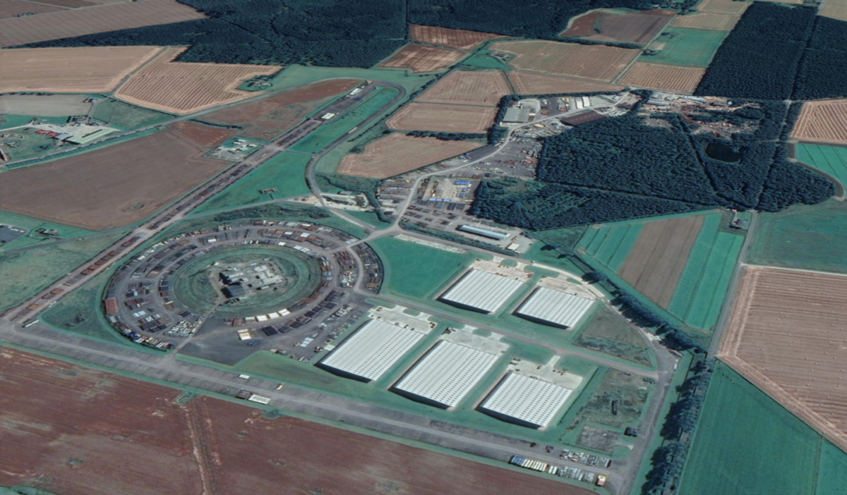
Five of Scotland’s 10 largest pieces of vacant and derelict land are not being brought back into use despite being deemed suitable for regeneration or development, The Ferret has found.
Three former RAF airfields, a disused railway line and an RAF airbase, collectively make up around 11 per cent of Scotland’s vacant and derelict land. However, plans to bring these five sites back into use, some of which have fallen into decay, have either stalled or are non-existent.
The other five of the largest 10 sites, which consist of open cast coal mines, a port and the once-largest explosives factory in the world, are being regenerated.
The Scottish Government uses data collected by local authorities to publish an annual list of registered disused land and buildings, to assess the scale of the issue and keep track of remediation.
In the 2018 survey, the latest available, 3,640 vacant and derelict sites were listed. They made up a collective 11,356 hectares of Scotland’s land – around 44 square miles and almost twice the size of Dundee – and the headline figures have not changed substantially since the late 1990s.
The 10 largest sites we analysed made up 2,449 hectares, or 22 per cent of the total. Almost all were derelict, in rural areas and privately owned. According to the survey, these sites have collectively lain derelict or disused for at least 260 years.
Three sites, including the largest, were in the Highland Council area. However, as the local authority has not updated its land survey since 2015, all of its previously listed sites were included the 2018 edition. The council was unable to confirm whether these sites were still derelict.
A council spokesperson stressed that the survey is voluntary and that it had the “busiest” planning department in Scotland. As such, surveying “the geographical size of Highland means that information can only be provided when resources allow”.
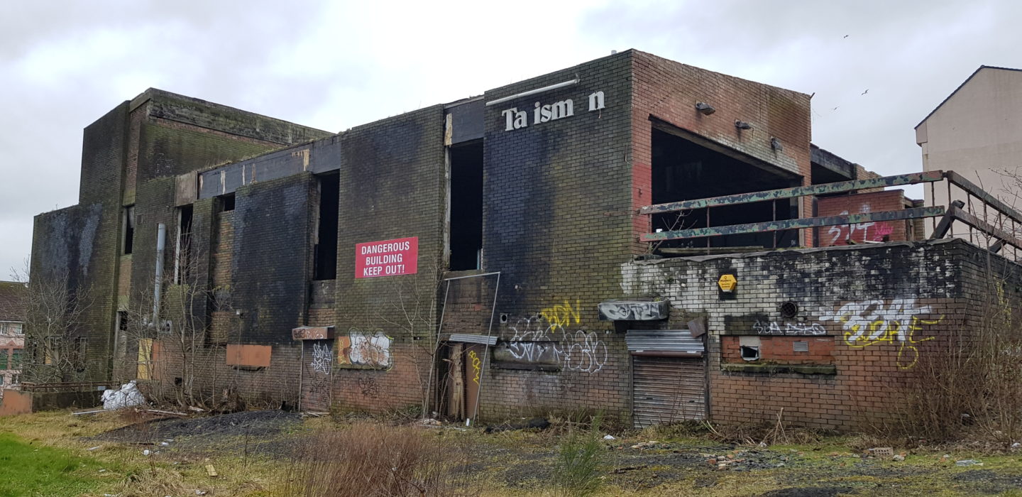
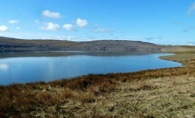
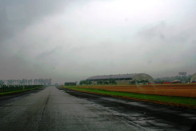
Fearn Airfield near Balintore, Scotland’s largest derelict site, is thought to have been derelict for at least four decades. According to Forgotten Airfields, the site was built in 1941 by the RAF before being “taken over and altered by the Royal Navy”. The Airfields of Britain Conservation Trust website says the site was handed back to the RAF in 1946 after “all units had disbanded or left the airfield” post-war.
The Ministry of Defence (MOD) confirmed that it no longer owns the airfield.
A title deed shows that 129.3 hectares of the site were purchased by J Scott & Partners in 2016. John Scott of the firm told The Ferret that the airfield is no longer used for flying but insisted the site is “far from derelict.” The runway is now used for “storage”, he said, while the land is used for “growing crops and grass” as part of Fearn Farm.
Within the airfield stands a former WW2 control tower, which according to the Mail Online, was bought in 2013 and converted into an Airbnb property. Contradicting Scott, the 2019 article says the runway is still used by private aircraft.
Highland Council was unable to confirm whether the site was still derelict.
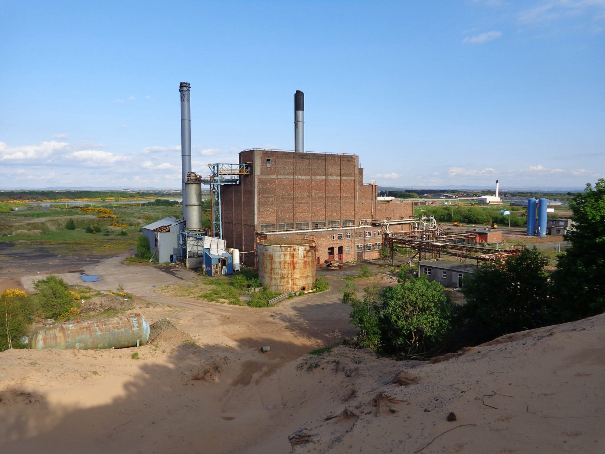
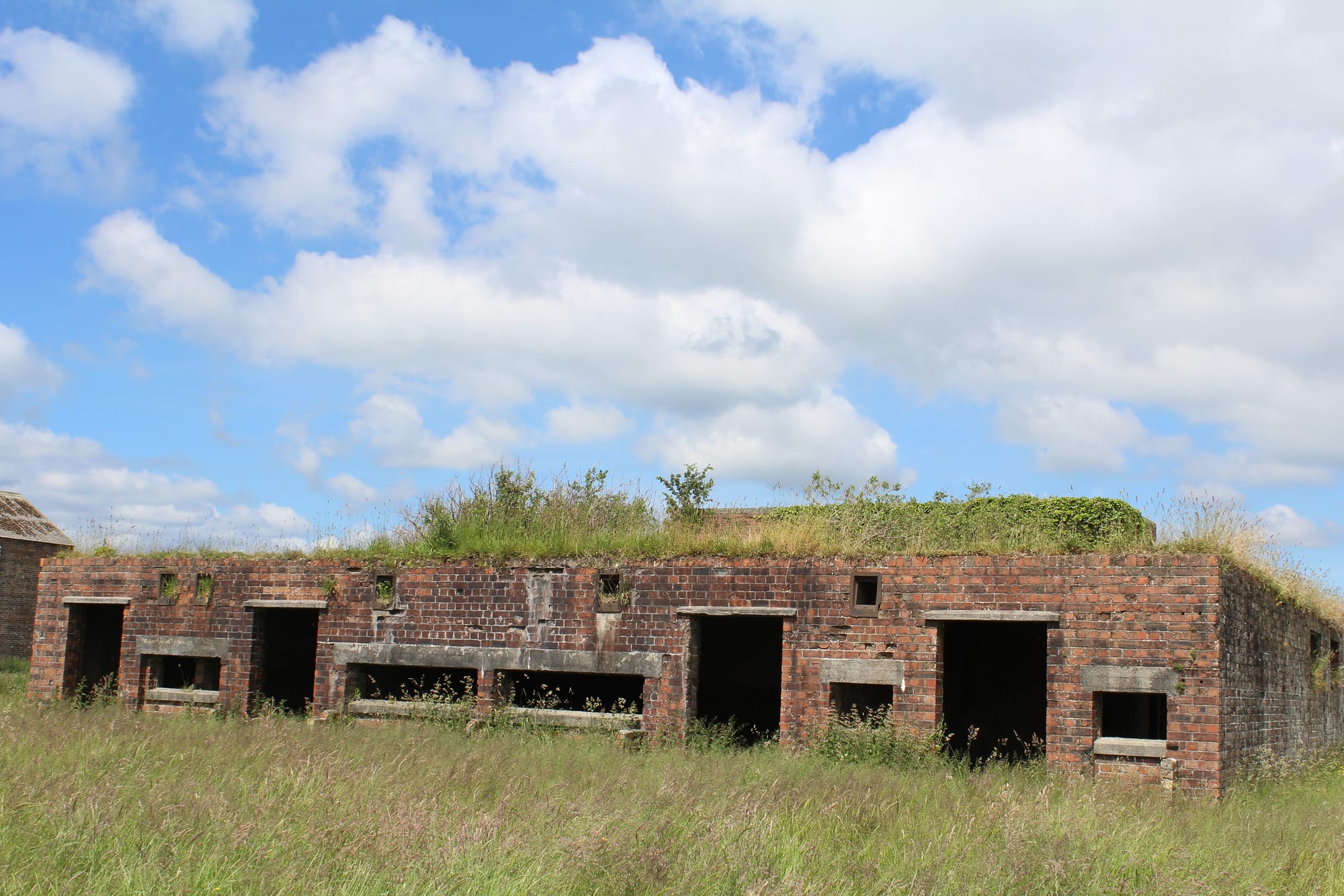
The Ardeer Peninsula was once home to the world’s largest explosive factory, which was opened in 1871 by the inventor of dynamite and Nobel Prize benefactor, Alfred Nobel. Producing explosives used in both world wars, the site once included train and boat links, a bank, a travel agent and a dentist, to serve over 13,000 employees at its peak, according to Deadline News.
The site was mostly deserted in the 1980s and became derelict in 2005. Coordinates in the land survey lead to a 148.9 hectare plot of land bought in 2010 by explosives firm Chemring Energetics. A Chemring spokesman said the site is used to produce aircraft mechanisms while the surrounding land is now owned by developers, NPL group. Chemring was “not responsible for the general dereliction of the area”, he added.
In 2019, NPL Group signed a deal with North Ayrshire Council to regenerate the peninsula as part of the Ayrshire Growth Deal. Initial proposals included commercial and tourism developments, new homes, and a road bridge over the River Garnock linking Ardeer and Irvine. The council hopes the project will attract tens of thousands of extra visitors each year.
In December 2019 conservation charities urged the council to protect the peninsula’s natural environment and important sand-dune system in light of the proposed development. They called for a Strategic Environmental Assessment to identify any negative impacts.
Three significantly smaller Nobel sites at Ardeer – totalling 56.52 hectares collectively – also featured in the land survey.
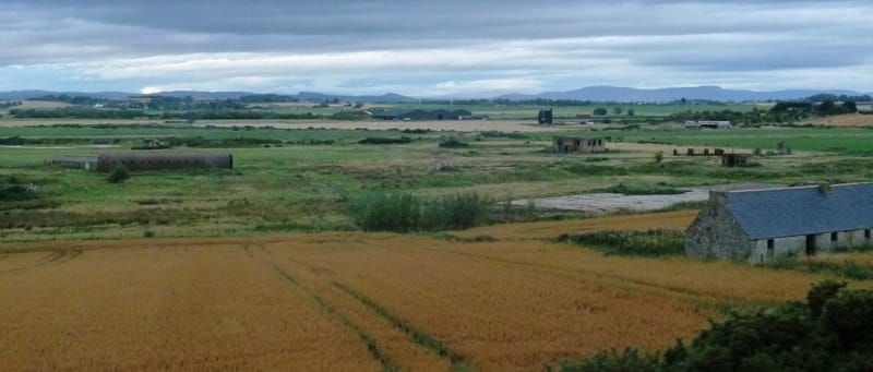
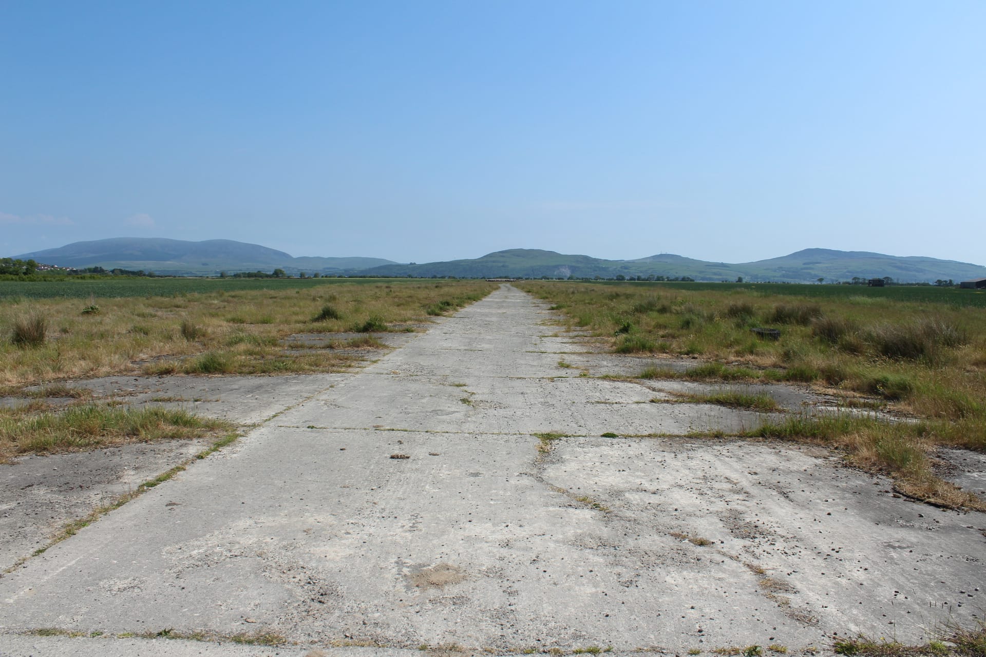
Also known as Tain Airfield, this patch of the Highlands was used by RAF Tain as a weapons range and WW2 airfield, according to Forgotten Airfields. Opened in 1941, the site is listed on Highland Historic Environment Record as having consisted of several hangars, three dispersal areas for parking planes and three runways, one of which housed an oil pipeline.
Having become derelict by 1980 at the latest, the MOD said it sold off part of the site, with the remainder used for training, and with no plans for redevelopment. Fendom is one of only three UK sites used to drop “1,000 pound bombs”, a spokeswoman confirmed. However, these bombs “cannot be live”.
There is no title confirming ownership associated with the site’s coordinates on the Registers of Scotland (RoS) digital map and Highland Council was unable to confirm whether the site was still derelict.


The former oil fabrication yard on the Moray Firth opened in the early 1970s and employed around 4,500 people at its height before closing in 2001, according to the Inverness Courier.
A planning application by new owners, the Derby-based Ardersier Port Ltd, proposed housing, a marina, a visitor centre, nature conservation zones, a hotel, and a sewage treatment plant.
Consent for the establishment of a port for energy-related uses, including dredging and the erection of offices, industrial and storage buildings, was renewed by Highland Council in 2019.
Kerri McGuire, an agent from Graham + Sibbald, the property consultants overseeing the project, said that renewed consent for the residential and leisure development was in process but had not yet been submitted to Highland Council.
“Given the scale of the development and site there is a statutory requirement to undertake community consultation”, she said.
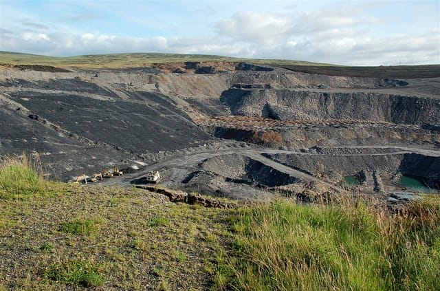
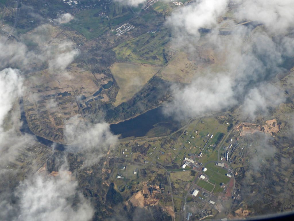
Once called Scotland’s Grand Canyon, the opencast coal site near Cumnock closed in 2013 when Scottish Coal went bust. Along with other East Ayrshire sites, these closures added 2,217 hectares of derelict land to the land survey in 2014. Despite partial regeneration, East Ayrshire still has the largest area of derelict land – 1,810 hectares, or 16% of the country’s total.
In June 2019, The Herald reported that birds had finally returned to the once uninhabitable Powharnal site following extensive regeneration work from the Scottish Mines Restoration Trust, East Ayrshire Council and others. Now a deep loch, Powharnel was one of several Ayrshire mines risking pollution, flooding and accidents.
David McDowall, the council’s operations manager for building standards and development said that “significant restoration work” had been achieved, such as remediating the ground habitat and watercourses, and forming new footpaths. McDowell said he hoped the project would be concluded by the end of 2020.
Another site formerly owned by Nobel Industries, this patch of land sits across the River Garnock opposite the former dynamite factory on the Ardeer Peninsula. It borders Irvine Golfclub and the Bogside Flats Site of Special Scientific Interest.
Having become derelict in 2005, the site is now owned by NPL group, which is planning numerous commercial and tourism developments with North Ayrshire Council as part of the Ayrshire Growth Deal.
A council spokesperson said they were “still developing” finalised plans.


Another opencast mine that became derelict in 2013 following Scottish Coal’s liquidation. A separate 138.29 hectare Benbain Remainder site is the 12th largest site in the 2018 land survey.
East Ayrshire Council said the former mining complex had returned to Forestry and Land Scotland but was working with the agency to regenerate it. With the site found to be unsafe, restoration efforts will now focus on “health and safety works rather than the infilling of the void”.
However, council operations manager David McDowell stressed that many “challenges” to restoration had arisen, such as a lack of finance and the sheer scale of the project. A proposed wind farm, which covers “a significant part” of Benbain Remainder had been submitted to the Scottish Government.
The wind farm’s construction “would overlap with works the council had intended to fund”, McDowell said. As such, restoration efforts would be “scaled down to areas not impacted by the wind farm proposal”, with hopes of commencing in 2020.

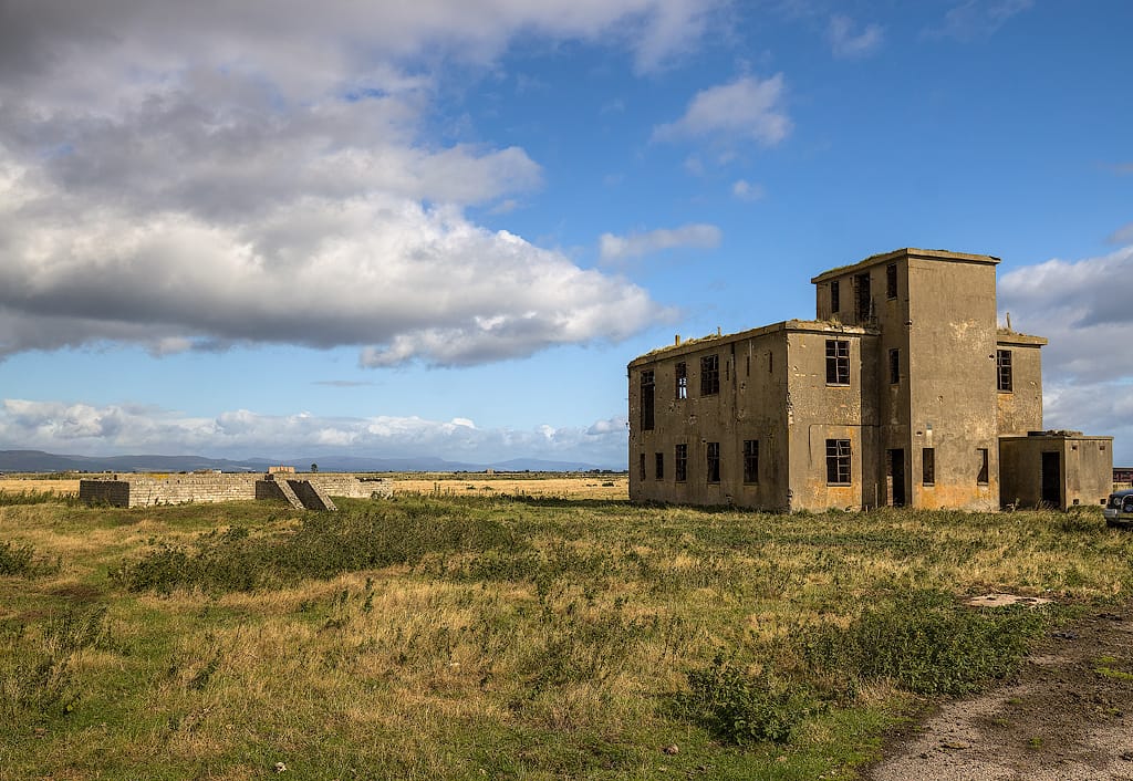
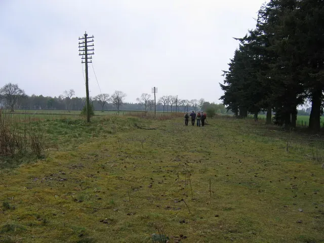
The former RAF Wigtown WW2 airfield has now been derelict for at least three decades. Despite closing in 1948, the site still housed control towers, hangars and 14 abandoned air raid shelters alongside its two runways as late as 2017, according to DGWGO. The MOD confirmed that it no longer owns the site.
In 2015, the BBC reported that plans for a solar farm at the site had been drawn up. Tenant developer Green Hedge Renewables claimed it could generate up to 20MW of annual renewable energy.
However, a spokesman for Green Hedge told The Ferret that the airfield was “no longer in our portfolio of current development projects”. In 2016, the business “diversified” from developing solar projects to battery energy storage projects, he added.
No further planning applications have since been put to Dumfries and Galloway Council.
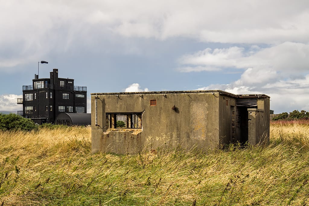
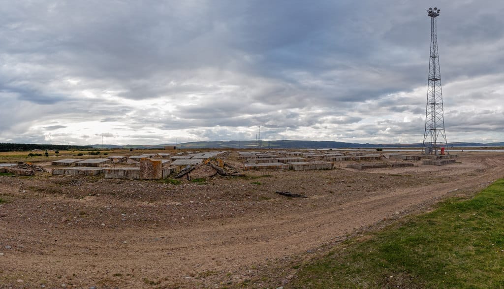
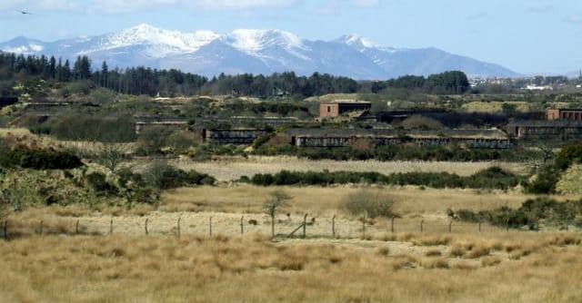
A former WW1 airfield, Edzell Airbase opened to civilians in the 1930s, before becoming RAF Edzell. It then housed 800 aircraft during WW2 and became a US ‘spy base’ throughout the Cold War, according to The Scotsman.
The Courier reported that up to 3,000 personnel were thought to have been stationed at the base before it closed in 1997, after the fall of the Soviet Union. The MOD confirmed that it no longer owns the airbase, which is now the largest recorded vacant site in Scotland.
In 2013, Carnegie Base Services was granted permission to build the first batch of 1,000 homes as part of a £250 million development including community facilities and shops. Aberdeenshire Council and Carnegie Base Services declined to comment on the latest stages of development.
However, NORR Consultants, the architectural firm involved in the project, confirmed that development had stalled due to a lack of investment. This followed the North East’s economic downturn as a result of the oil price decline.
A spokesman from the firm added that large parts of the base, including the runways, were being used for industrial storage.
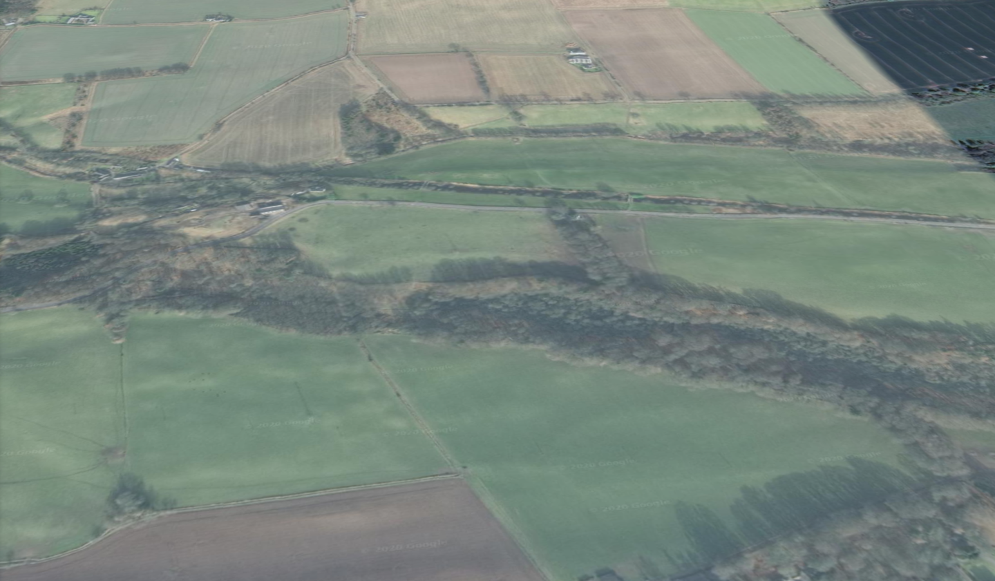
This far-spanning former railway line in Angus was owned by Network Rail and run by railway franchise holders while operational, according to the land survey. The Angus Railway Group said the site appeared to be what was known locally as the Strathmore line.
Ian Foulis, the group’s secretary said the line “ran from Stanley Junction near Perth to Kinnaber Junction, north of Montrose, through Coupar Angus, Forfar and the Bridge of Dun” before closing to passengers in 1967. However, part of the line “remained open for freight until the early 1980s.”
The land survey states that remapping an area of disused railways using aerial photography resulted in an increase of 30 to 166 hectares of recorded derelict land in Angus. According to RoS, the extent of railway lines would be “impossible to identify” without a plan of the land.
An Angus Council spokeswoman said that permissions “may have been granted for works on former railway lines”. However, the council did not “hold information that identifies when such permissions are on former railway land”.
Network Rail confirmed that it owns a number of unused sites in Montrose, Arbroath and Brechin, but said it would not class them as derelict and is holding on to them for potential future use as freight yards.
“We work hard alongside our regulator, The Office of Rail and Road, to manage our estate and free-up land for other uses whenever possible”, a spokesperson said. “However, we do have to consider the potential future growth of our infrastructure and will retain land which we feel has a strategic value, even if it is not likely to be used immediately.”
For each site, we aimed to discover the current owner, historical usage, and what, if any, remediation plans were in place. We did so by using the coordinates given on the Scottish Land Survey to locate each site on the Register of Scotland (RoS) interactive land map. In most cases, the coordinates led us to a plot of land included on the modern RoS register.
However, most of these plots were smaller than the size listed on the land survey and in two cases, slightly larger. Some were also surrounded by other individually-owned plots or unregistered swathes of land. This suggests that each site is now owned by multiple land owners. In each case, we focused on the plot that encompassed the coordinates given in the Scottish Land Survey.
For sites that did not appear on the register, we contacted local authorities, former owners, developers and others to seek out use and ownership.

Thousands of species rely on Scotland’s indigenous trees to survive. In our public woodlands, they’re vastly outnumbered by non-native timber plantations.

The company that runs Scotland’s ageing nuclear power station wants to weaken safety standards to keep it running for at least four more years. But the nuclear safety watchdog has its doubts.

Tensions are high in Glasgow following a series of protests over alleged sex crimes by migrants. Police and anti-racism groups fear extremists could inflame the situation.


The Scottish Government gave local authorities £20m to tackle a "nature emergency". But we found that around £4m of that sum was spent on fixing cars and office equipment, among other non-environmental spending
